
Are There Any Trails That Aren't Crowded at New River Gorge?
Absolutely. The park covers over 70,000 acres and has more than 50 miles of trails, and the vast majority of visitors funnel onto two or three of them. Step even slightly off that beaten path and you can have the forest entirely to yourself. Here's where to go.
First — the truth about Long Point and Endless Wall
Long Point and Endless Wall are popular for a reason. The views are genuinely among the best in the park and both trails are worth doing even if you share them with other people. If crowds bother you, the simple fix is timing: early morning on any day or a weekday visit makes both trails dramatically quieter. Don't skip them just to avoid people — go at 8am on a Tuesday and you'll likely have them to yourself anyway.
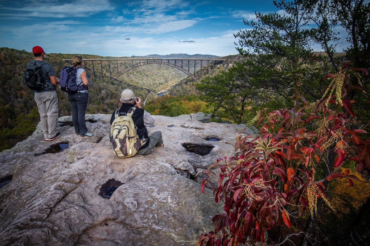
Long Point Trail’s payoff. photo credit iron arch photography
Close to Fayetteville
Bridge Trail starts near the Outpost just outside downtown Fayetteville, which makes it one of the most convenient trails in the park. It's short and strenuous at just under a mile, but it delivers genuine views of the bridge and is surprisingly uncrowded given how close it is to town. A great option if you want a quick trail fix without driving anywhere.
Brooklyn Mine Trail is one of our personal favorites, especially in the winter and early spring when the leaves are off the trees. The trail passes through the site of the old Brooklyn mining town — one of many coal communities that once lined the gorge — and the bare winter forest opens up views you simply can't get in summer. We rarely see another person out here.
Kaymoor comes in two distinct flavors. The Kaymoor Miners Trail is a steep, strenuous descent of 821 steps down through the ruins of a historic coal mining operation — headhouse structures, equipment, and industrial remnants being slowly reclaimed by the forest. It's short and dramatic and the ruins at the bottom are genuinely eerie and beautiful. The Kaymoor Trail proper is a completely different experience: a long, quiet trail running from Cunard all the way to Fayetteville that sees very little traffic. If you want solitude on a longer hike, this is one of the best options in the northern part of the park.
Down by the River
Southside Trail runs right along the riverbank on the south side of the gorge — flat, wide, and peaceful. It's one of the few trails in the park where you're actually at river level, and it stays quiet even on busy weekends. Good wildflower viewing in spring, and the sound of the river the whole way. Keep an eye out for the offshoot paths down to the river's edge — one of them puts you right at Surprise Rapid, which has a well-earned reputation as the number one spot for flipping rafters out of their boats on the Upper New. It's a safe place for it to happen, which is part of why the outfitters run trips through it — but from the bank you get a front-row seat to the chaos. On a busy summer day it's genuinely great entertainment.
Stone Cliff Trail is another river-level walk, this one starting near the historic railroad town of Thurmond on the south end of the park. It follows an old road along the banks of the New River for 2.7 miles with great river access and virtually no other hikers. AllTrails reviewers consistently note they didn't see a single other person on the trail. The endpoint leads to a stand of old-growth forest — rare in this region because most trees were cleared during the coal era. Worth noting: the directions to the trailhead are not obvious. From US-19, take the Glen-Jean/Thurmond exit, follow the signs for Thurmond on WV Route 25 for 6 miles to a three-way intersection, bear right for 1.5 miles, then turn right on the gravel road just before the bridge crossing the New River. Continue past the boat launch to the parking area.
Rend Trail — If you're already heading down to Thurmond, this is a natural add-on. The trail follows an old 1906 railroad corridor along Arbuckle Creek and the New River, crossing several old wooden trestles, and gives you a great overlook of Thurmond and the river. The highlight is a house-sized sandstone boulder that detached from the cliff above, bent and then snapped the old railroad tracks underneath it, and now sits in the middle of the trail. The park has built permanent stairs around it. It's the kind of thing that makes you stop and think about the scale of what's around you. One practical note: a bridge closure has split the trail into two shorter segments — you can hike about 1.9 miles in from the Thurmond trailhead before hitting the closed section. The open portion is still well worth it.
Southern Section of the Park
The southern end of New River Gorge — down near Sandstone — gets a fraction of the visitors that the Fayetteville area sees, and the trails here are reliably quiet.
Glade Creek Trail is one of the most beautiful long trails in the park and almost nobody does it. It's 11.2 miles out and back, but the trail is wide and gently graded and you can hike just the first half and turn around whenever you like. There's a waterfall, what many people call the best swimming hole in the park, and Kate's Falls near the southern trailhead that's a genuine stunner. An all-day adventure that will likely be all yours.
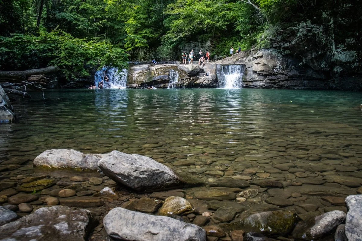
Glad Creek swimming hole. photo credit iron arch photography
Gwinn Ridge Trail is a quiet 3-mile loop near Sandstone Falls that winds through older forest mixed with former pastures slowly reverting back to nature. Peaceful, gentle, and almost always empty.
Big Branch Trail is short and strenuous — a 2-mile loop through a cove forest with multiple waterfalls and the ruins of an old farmstead. Timing matters: too dry and the falls aren't flowing, too wet and the trail gets slick. But if you hit it right, it's one of the most rewarding short hikes in the park.
One for the Adventurous
Terry Top Trail is a 3.82-mile out-and-back on an old ridgeline road that is genuinely off the beaten path — open forest, a quiet pine thicket, a family cemetery from the 1800s, and a vernal pool (frog pond) that's worth the trip on its own. We're including it partly because the trailhead is so hard to find that it's kept many people away, including us for a long time. Here's how to get there:
From Fayetteville, take US-19 South for 10.8 miles. Exit left toward Glen Jean (look for the Exxon/Subway on the left). Turn right at the stop sign onto WV-6 S/WV-61 S. Travel 2.7 miles and turn left onto WV-61 South. Travel 1.9 miles and turn left onto Jack Furst Drive at the large Summit Bechtel sign. Drive 1.1 miles and take the first paved road on the right (Mill Creek Rd). Drive 1.6 miles past the National Park boundary sign — the trailhead will be 0.4 miles inside the boundary on the right, marked by a small pole sign that's easy to miss. "Terry Top Trl" is searchable on Google Maps.
One current caveat: large-scale strip mine restoration is happening along this trail right now, and the scenery beyond the frog pond is reportedly quite bleak. For the time being, hike to the frog pond and turn around — it's worth it on its own.
A Note on Leaves
One thing worth knowing about this gorge: when the leaves are on the trees, views from the rim trails are limited. Long Point and Endless Wall are popular partly because they're among the only rim trails that reliably deliver gorge views even in full summer foliage. Most other trails give you beautiful forest but not the dramatic cliff-and-river panoramas. The trade-off is that those quieter trails in summer are lush, cool, and full of wildflowers and wildlife — a completely different but equally rewarding experience. And in winter and early spring, when the leaves are off, trails like Brooklyn Mine suddenly open up in ways that will genuinely surprise you.
The short version: go anywhere other than the Long Point and Endless Wall parking lots on a Saturday afternoon in the summer, and you likely won’t be feeling crowded. The park is enormous. Most people don't know the half of it.